CTrends Cloud Apps
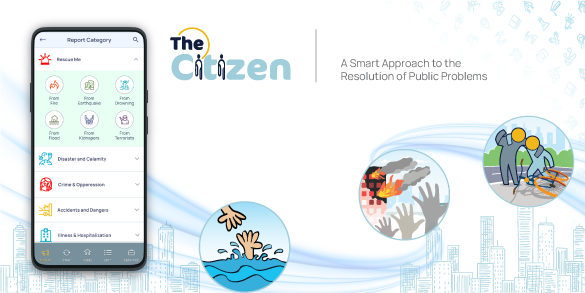
CTrends TheCitizen (TM)
In our social life, we encounter various troubles during our travel every day, e.g., social security incidents, utility line / service damage, emergency situations, etc. but the government notices them with much delay and prolongs citizen sufferings. We have developed the TheCitizen platform to bring government and private service agencies to the platform to ensure collaboration with the citizens for resolving public issues. This app enables the resolution of various types of citizen problems. Therefore, the citizens will use this app for different reasons. We believe that this app would revolutionize the way people interact with the government and private service agencies. It would create a transparent platform of government-to-citizen interactions.Citizen empowerment:
The app would enable the mass people to bring incidents to authority’s attention seamlessly. It would trigger a higher level of confidence among people that their words can reach the authority instantly without modification, and their reports count. Citizens would become more engaged and participatory in social development. A user will be able to post an incident or utility condition at his location with evidence. The user will select the right type of incident from the navigation panel and take a photo or video of the situation / facility / incident and post it in the app. The following accuracies will be ensured:
- The app will take the location coordinates (longitude, latitude) from the handset internally. So, the user cannot report a wrong location.
- The app will take only the camera stream. So, the user cannot post images from photo gallery.
Developing countries are commonly observed with lower level of accountability in government agency officers. This app would significantly improve agency officers’ accountability. Because, public incident reports will be visible to citizens and their remedial actions. The service agencies would be helped in the following ways:
- Instant reporting of broken utilities / facilities / emergencies across the geography to the corresponding officers
- Agencies can plan and assign persons to repair the facilities / utilities.
- When the repair staffs resolve the problems and post update, the agency offers and the original reporting users will get auto-notifications.
Measurability of impact:
The app provides the facility to measure public reports and effective closure of reported incidents. Both users and agency officers can see these reports which would also bring transparency.
Geo-routing:
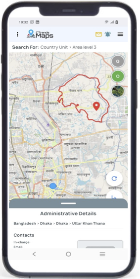
It is the app which automatically determines the officers on duty for the reporting area and sends the reports with geolocation and supporting images. It cannot be done manually to support the user base. The system can detect area boundary of the shout-matter jurisdiction. The routing area can be defined at Level 0 to 9 of country unit or customer region. An illustration is given to the right. Please contact us for discussing your case and creating a solution for it. Read More
Supported OS: Android
Download and install the Android APK:
The Public App @Google Play Store The Agency version
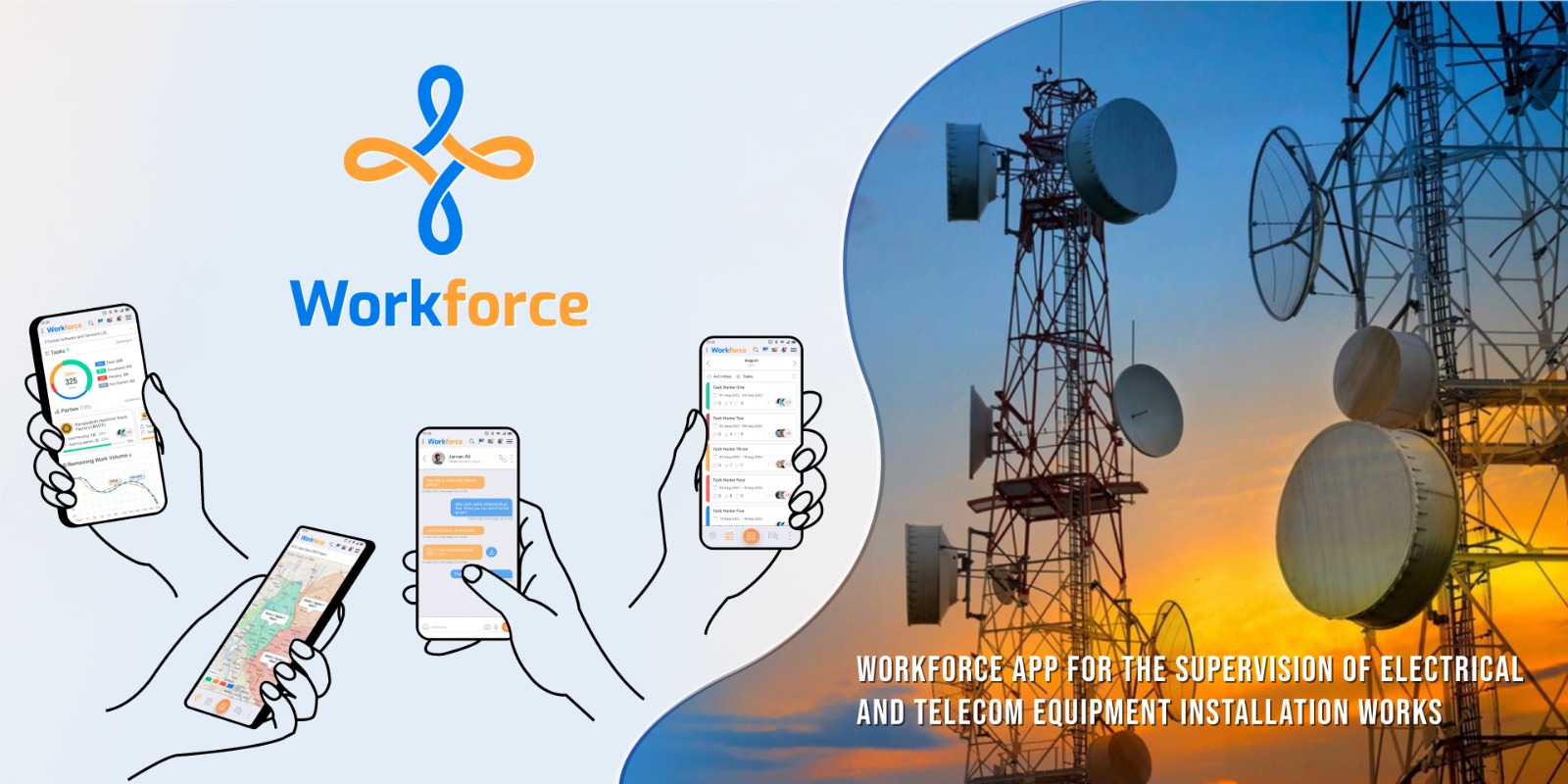
Telecom Network Rollout & Monitoring:
This feature is designed only for telecom network projects. This is a complete GIS-based NMS containing the network design.
The rollout team can work in the field by following the topology and pole/equipment locations at each geography such as union boundary.
Equipment status can also be monitoring using SNMP.
- Network designs can be done from survey data (site details including lat/lng) posted by CTrends iSurvey app
- Complete network topology design on online map canvas
- Both optical fiber and wireless networks can be designed
- OFC core & BW details can be maintained for each link
- Each network link will automatically get accurate length calcualted from GIS
- Each telecom equipment can be created with significant technical data
- The network topology can be designed in geography-wise segregation
- POP, WiFi AP, router, switch, splitter, ONU and many other devices can be used in design
- Poles, cables and devices are shown in different shapes and colours based on their types
- Each equipment's status can be monitored on the map if the equipment supports SNMP
- Trouble ticketing can be managed, etc.
Employee Services:
These features are designed to support companies / agencies to allow their employees / associates to perform common activities from anywhere:
- Locatio-based attendance
- Leave request
- Travel request
- Loan / advance request
- Expense reimbursement claims
- Official notifications, etc.
CTrends Workforce
Multi-vendor Project Management:
When there are multiple contractors of a large project for different work areas, every party has its own project management in addition to the central project office (PD).
Key features:
- Multiple vendors can work in the same project online in a collaborative model
- Each vendor will work only on the tasks assigned to it. It cannot post any progress or status to other vendors' activities.
- The central project office needs to spend any effort to compile the work progress of the contractors.
- Full RASCI model can be implemented for each activity. Each R-A-S-CI-I role for individual activity can be assigned to different persons.
- Each RASCI role's progress can be tracked.
- Each activity can be restricted to specific geographies (such as District / Upazila / Union) using the GIS facilities of CTrends Maps.
- A worker cannot physically work (construction / equipment installation / inspection / testing) outside the assigned geography.
- Project tests (such OAT / FAT) can be done using the app preserving the evidence.
- New site creation / site relocation / site dropping can be done online with PD's approval.
- Inter-dependency on project team members can be tracked, etc.
Supported OS: Android
CTrends Maps Platform
We have developed a geographic service to help enterprises to develop apps using geographic controlling, geographic routing and related services. All the CTrends apps use this service through REST API services. All other organizations are welcomed to use CTrends GIS API services through a simplified service contract. The level definition for different countries is different. We have the following level definitions for Bangladesh:
- Level 0 - Country
- Level 1 - Division
- Level 2 - District
- Level 3 - Upazila (Sub-district)
- Level 4 - Union
- Level 5 - Mouza
- Level 6 - Village, etc.
- Administrative unit polygons of latitude and longitude for each country on earth.
- The administrative unit polygon can go up to Level9. But the data is available up to different levels for different countries.
- You can search the responsible persons / offices for a particular service for a particular geographic unit.
- You can route a service request based on the user's location.
- You can determine the jurisdiction of a particular location in any supported dimension, e.g., police, city corporation, gas distribution, electricity distribution, etc.
- And many more...
People can interact with different authorities from different map objects. They can see and participate in the related processes right from the map.
Using this map, different authorities can do many things including the following:
- Road contruction management
- Road cutting permission
- Tree cutting permission
- Billboard placement permission
- Road safety audit and safety raing
- Real estate projection plot management
- Detailed area plan (DAP) specifications, etc.
Supported OS for App: Android
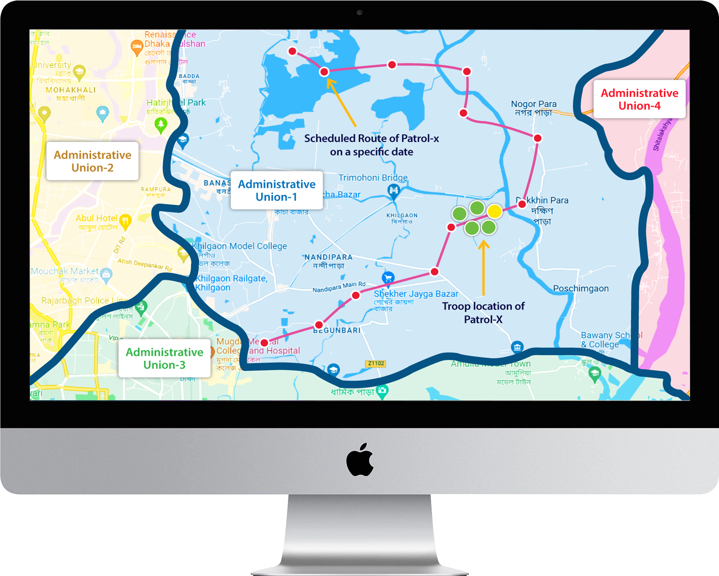
CTrends Patrol Monitoring System
It is a GIS-based online patrol / team monitoring system. It can be used for security patrol monitoring as well as commercial field force monitoring based on planned routes. Our patrol monitoring system has two major components – (1) a patrol management portal and (2) a mobile app for the field officers.
PATROL MANAGEMENT PORTAL
A Java based secure web portal will be developed to work as the tool for planning all the patrol elated tasks and monitoring the patrols. It will have all the web-based reporting interfaces and monitoring dashboards so that officers can access them from any device without having it installed on their device. It ensures high portability.
It will be a very flexible mobile developed by Google Flutter which will run on Android, iOS and Windows-based smartphones and tablets. The field force cannot carry a computer or expensive devices with them. But they can surely carry mobile phones in their pocket. It is also very unusual that a field personnel does not have a smartphone at this time of smart user devices. However, in case it happens, the management may consider supplying smartphones to the field force to install the patrol app. Each field official must enable location-access to the app on his phone. The app should work automatically without field force’s interactions. During the patrol, the app’s primary job will be posting user location to the server every 5 seconds or so.
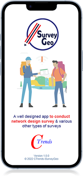
CTrends iSurveyGeo (TM)
CTrends iSurveyGeo is a survey app with which you can control the survey operation with geographic authenticity. This is a paid app for the enterprises, but free for the individual users. Enterprises can host survey projects of various kinds, e.g.:
- Network Site Survey for design (Mobile, WiFi, LAN, etc.)
- Equipment Survey / Asset Verification (IT, Mechanical, Electrical, Building, etc.)
- Telecom Signal Survey (WiFi, 2G, 3G & 4G)
- Engagement Survey (Employee, Customer, Distributor, Retailer, Vendor)
- Environment Survey
- Civil Infrastructure Survey (Road, Bdidge, etc.), etc.
You can assign specific administrative geographies (e.g., districts, upazilas, unions, etc.) or custom regions (e.g., corporate demarcations of a country). It currently supports up to Level4 geo-unit of a country, but can go down up to Level9. Different levels are supported for different countries. For Bangladesh it is Level4 (i.e., union). If you want to know the supported level for other countries, please contact us.
You can get the following special benefit of survey using this app:
- The surveyor has to be physically inside the assigned geographic unit (administrative or custom) to post survey data. It ensures that the surveyor did not post data without visiting the assigned sites
- The surveyor can post the supporting images only from the camera stream which helps to ensure the image authenticity.
- The survey manager (using the iSurvey Manager app) can monitor the survey progress of his areas, individual surveyor, etc.
- The survey manager can check data accuracy and provide feedback (accept / reject) so that the surveyor can correct & re-post.
- The survey manager can see the surveyor's movement trace to determine whether the surveyor moved around the whole geo-unit to conduct the survey.
- The entities can download the survey data with the related images from the survey portal with much ease.